Gigabytes over WeTransfer or Drive that the client never opens, or can’t.
Drone data inspection and delivery platform
Stop delivering files. Deliver answers.
Upload the orthomosaic, LiDAR point cloud and 3D model you already produce. Mark every defect on the original photo and deliver it to your client in a link.
Send us a project and see it published within 48 hours, with 3 tasks assigned.
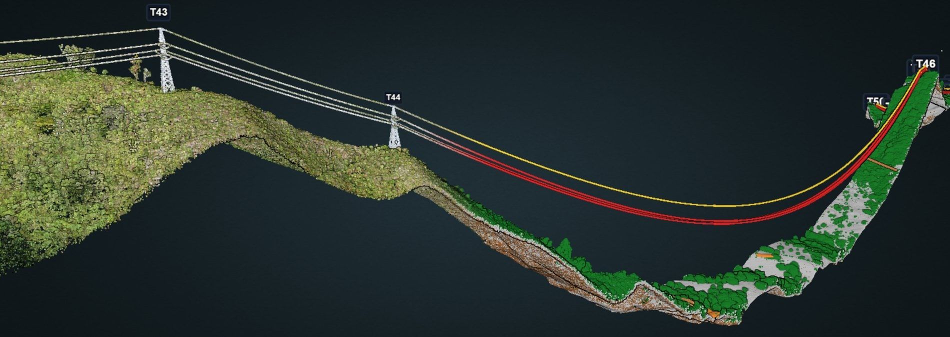
Real-world inspections across energy, roads, bridges and buildings
14industry defect catalogs
66bridge typologies
25+input formats
600+ hain a single campaign
Drone data gets lost between the flight and the decision.
Screenshots pasted into Word and a defect table nobody can find again.
The ortho in one program, the point cloud in another, the 3D model in a third.
How it works
ECWLAZCOPCDWGGeoTIFF3D TilesOBJR-JPEG360°
1 · Upload
Scout Publisher, included in every plan, converts and uploads your deliverables from your PC. No QGIS, no ECW license.
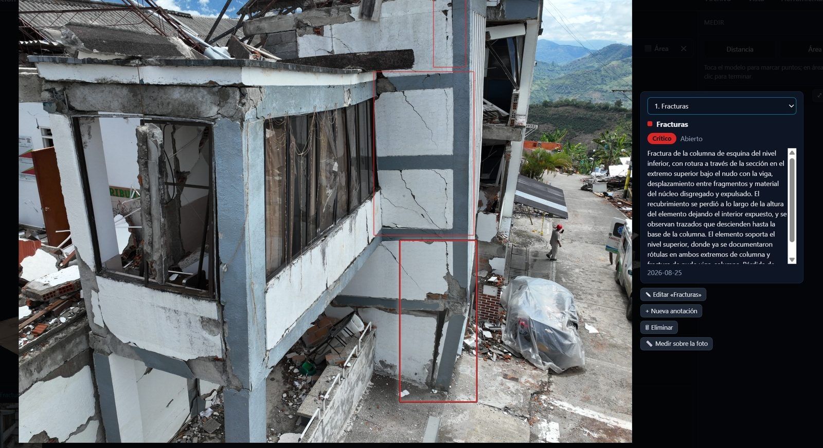
2 · Inspect
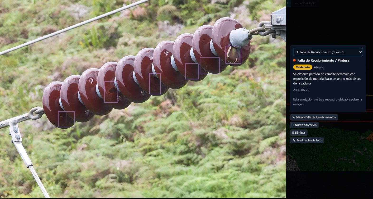
Click the model, get the flight photo that sees that point, and mark the defect with its severity.
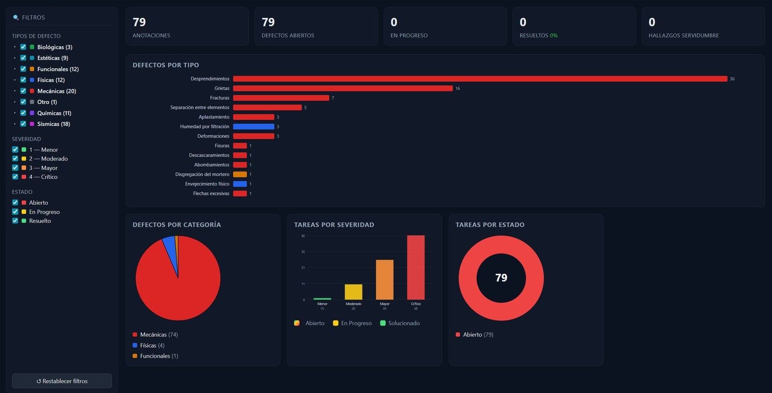
3 · Deliver
Dashboard, tasks with owners, and reports in PDF, Excel or interactive 3D web. Your client opens it in a link.
Scout Online doesn't process photogrammetry or fly missions. It takes what you already produce in Agisoft Metashape, iTwin Capture, DJI Terra, LiDAR360 or other software.
Everything in one view
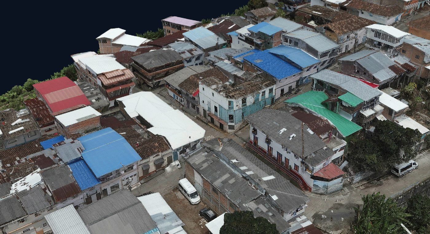
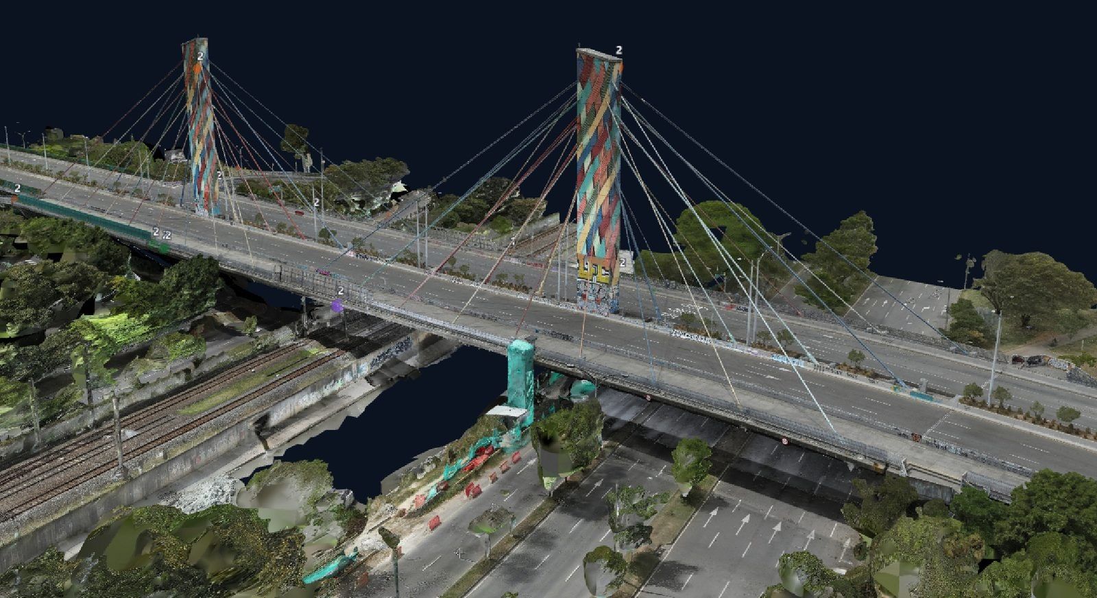
Ortho, 3D, LiDAR and photos on one screen.
Mesh, point cloud, orthomosaic, DSM/DTM, 360° and CAD drawings in 2D, 3D or side-by-side view, with linked cameras. No switching programs or tabs.
From flight to finding
Click the model, get the right photo, mark the defect.
Scout Online shows the flight photos that see that point, ranked by resolution. You mark the defect on the original photo and add its severity, cause and recommendation. The finding then appears in the 3D model, the map, the dashboard and the report.
CriticalMajorModerateMinor
Delivery that gets used
Your client opens it in a link.
Unlimited viewers on every plan. Links carry an expiry date and you can revoke them at any time. From Partner up, each client gets an isolated workspace. Nobody installs anything.
Engineering-grade accuracy
Your coordinates, untouched.
Scout Online keeps your project's native coordinate system, whether MAGNA-SIRGAS, UTM or State Plane in feet, and never silently reprojects. Profiles, cross-sections and cut-and-fill volumes, measured in true meters.
Built for people who deliver inspections
For drone service providers
Stop delivering files. Deliver answers.
Each of your clients gets an isolated workspace inside your account and sees only their own data. You deliver one link with the ortho, 3D model, point cloud and findings. You sell inspection, not just data.
- Isolated client workspaces: 40 on Partner, unlimited on Enterprise.
- Your logo on the reports.
- Deliverables from any software: Metashape, iTwin Capture, DJI Terra, LiDAR360.
- Multi-temporal monitoring: sell every campaign as a recurring service.
- White label: ask us.
For engineering and consulting firms
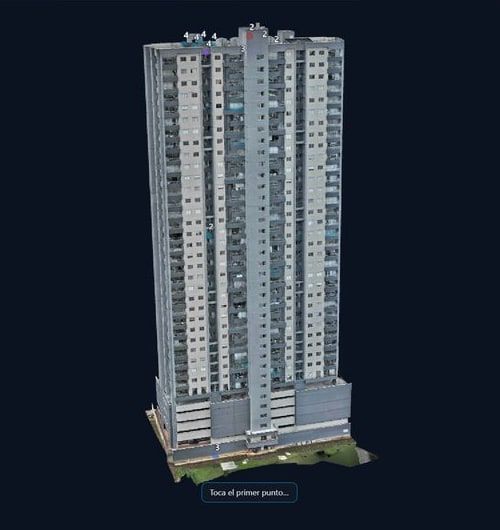
The diagnosis is your product. Scout Online gives every finding its photo, its 3D location and its owner, and gives your client read-only access with no extra licenses.
Structures & bridges66 bridge typologies with element-level defects; façades with seismic codes.
RoadsReference PCI calculation (ASTM D6433) from 360° and ortho; profiles and cross-sections on the DTM.
Geotechnical & earthworksCut-and-fill volumes, slopes and campaign-to-campaign differences on slopes and landslides.
EnvironmentalLand-cover change between campaigns, corridor vegetation, and flood and landslide scenarios.
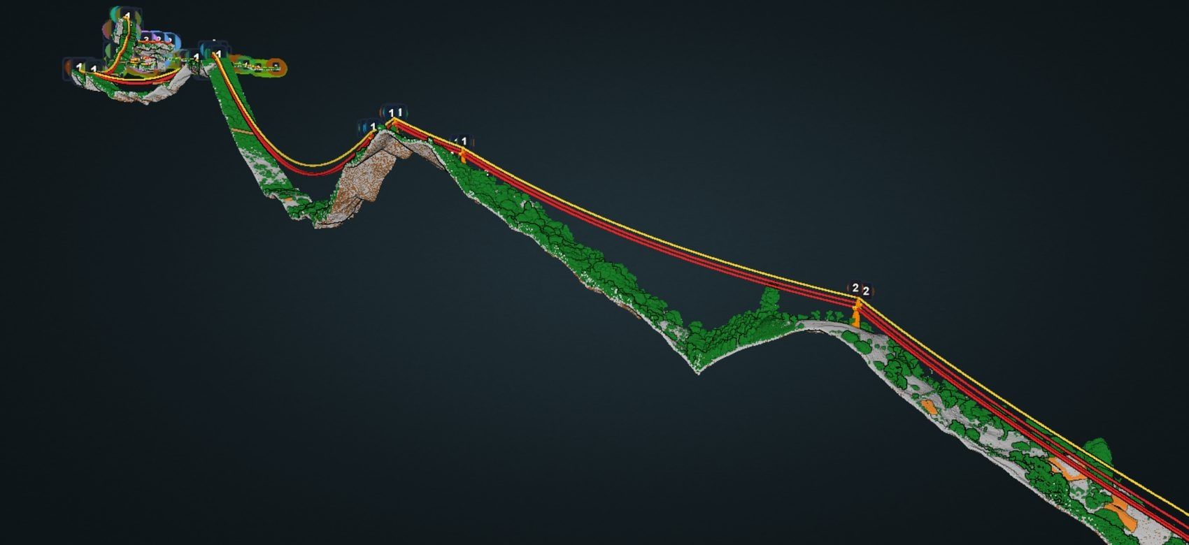
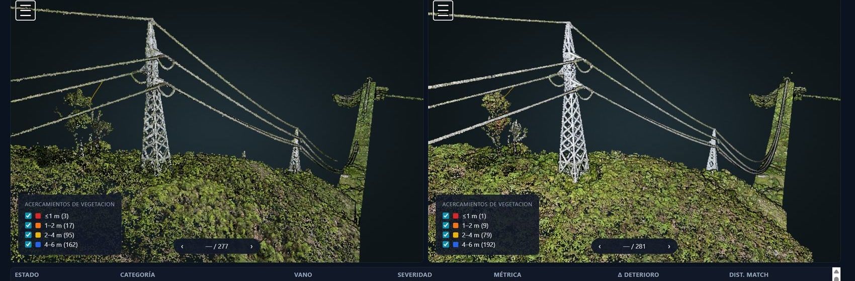
Power T&DVegetation-to-conductor clearance measured in the LiDAR cloud, right-of-way and radiometric thermal.
Survey & GISDWG/DXF drawings on the 3D model, native coordinates, and export to SHP, DXF and KML.
What's inside
COPC streaming, color by class or height, profiles and measurement.
Elevations, profiles, cross-sections, contours, and cut-and-fill against 7 base types.
Compare campaigns and detect new buildings and earthworks.
From PartnerDJI R-JPEG radiometric viewer with palettes, ΔT and NETA classification.
Street-level tours with markup on the panorama and automatic face blurring on upload.
DWG and DXF as layers on the map and in 3D, draped on the terrain.
Georeferenced interior tours inside Scout Online.
PDF, Excel and interactive 3D web reports, with your logo.
Owner, due date, inspector → reviewer workflow and a daily email digest.
Roles by company, asset or campaign, plus read-only share links.
Building footprints with flood and landslide scenarios.
Power line and pipeline corridors: conductor clearance, right-of-way and span by span.
Studio add-on · included from PartnerYou pay for projects and storage, never per seat.
Unlimited viewers on every plan. Going over your user limit never locks anything.
Scout Online is coming soon to your country.
For now we serve companies in Colombia. Leave your details and we’ll let you know when it’s available in your region.
Keep me postedWhat each level includes
| Field | Studio | Partner | Enterprise | Government | |
|---|---|---|---|---|---|
| Capacity | |||||
| Active projects | 5 | 15 | 40 | 100 | Custom |
| Storage | 100 GB | 500 GB | 1.5 TB | 4 TB | Custom |
| Users with an account | 10 | 20 | 150 | 500 | Custom |
| Link viewers | Unlimited | Unlimited | Unlimited | Unlimited | Unlimited |
| Inspection | |||||
| 3D viewer (mesh, splats, orthomosaic, point cloud with measurement), 360°, findings, tasks, PDF and Excel reports | Included | Included | Included | Included | Included |
| Radiometric thermography | Included | Included | Included | Included | Included |
| GIS/CAD export (SHP, DXF, KML) and your logo on reports | Included | Included | Included | Included | Included |
| Linear Projects module (power lines, pipelines) | — | Add-on | Included | Included | Included |
| Change detection | — | — | Included | Included | Included |
| Security & administration | |||||
| Two-factor authentication (2FA) for anyone who wants it | Included | Included | Included | Included | Included |
| Isolated client workspaces | — | — | 40 | Unlimited | Unlimited |
| SSO, API and access audit log | — | — | — | Included | Included |
| Dedicated data residency | — | — | — | Setup fee | By contract |
| Service | |||||
| Custom report templates | — | — | — | Included | Included |
| Support | Priority | Account manager, onboarding & SLA | SLA, training & procurement support | ||
| Purchase | Monthly or annual | Monthly or annual | Monthly or annual | Annual contract | Public procurement |
Your data, encrypted and under your control.
- Encryption. Private storage, every campaign in an encrypted database, and downloads through signed links that expire.
- Access. Optional two-factor authentication on every plan, login lockout and permissions by company, asset or campaign.
- Traceability. A log of every download and an audit trail of every change to a finding.
- Continuity. Encrypted daily backups, minute-by-minute monitoring and a 30-day trash bin.
- Offline. Scout Desktop runs on air-gapped networks, with a machine-locked license.
- Your data is yours. Download originals and export to open formats whenever you want.
Frequently asked questions
Does Scout Online process my photos?
No. Scout Online doesn't do photogrammetry or fly missions. It takes what you already produce in Metashape, iTwin Capture, DJI Terra, LiDAR360 or other software, and handles inspection and delivery.
Which formats does it accept?
3D Tiles, GLB, OBJ, LAS/LAZ/COPC, GeoTIFF, ECW, JP2, DSM/DTM, JPG and TIF photos, R-JPEG thermal, equirectangular 360°, Gaussian splats, DWG/DXF, SHP, KML/KMZ and GeoJSON. Publisher converts them on your PC, with no QGIS or ECW license.
Who counts as a user?
Anyone who creates projects, uploads data, marks findings or manages tasks. Link viewers don't count, and they're unlimited.
What happens if I go over my limits?
Nothing locks. We notify you and you have 60 days. If you're less than 20% over, we raise the limit at no cost; if it persists, we bill extra users or you move up a plan. When you hit your storage limit, only uploads pause: we never delete anything or bill you without notice.
Is my data mine?
Yes. Download the originals and export to SHP, GeoJSON, DXF, KML, PDF and Excel at any time.
Does it work offline?
Yes, with Scout Desktop, the edition for air-gapped networks. Ask us about licensing.
Which coordinate systems does it use?
Your project's own: MAGNA-SIRGAS, SIRGAS, UTM or State Plane in feet. Scout Online never silently reprojects and measures in true meters.
Where is my data stored?
In private Cloudflare R2 storage and on servers in the United States. If your contract requires a specific country or provider, Enterprise offers dedicated data residency.
Do you use AI?
Today the engineer makes the call: Scout Online doesn't detect defects automatically. Assisted detection is in development, and we'll announce it when it's in production.
How do I get started?
Send us a sample project. Within 48 hours it's published in Scout Online with 3 tasks assigned, and we walk through it together on a call.
See it with your own data.
Send us a project and within 48 hours it's live in Scout Online, with 3 tasks assigned.
Message us on WhatsApp